Earth's history spans about 4.54 billion years, divided into several key eras:
1. Hadean Eon (4.54 to 4 billion years ago): The Earth formed from the dust and gas surrounding the young Sun. It was initially molten, with frequent asteroid impacts.
2. Archean Eon (4 to 2.5 billion years ago): The Earth's crust cooled, and the first signs of life, such as simple single-celled organisms, appeared.
3. Proterozoic Eon (2.5 billion to 541 million years ago): Oxygen began to accumulate in the atmosphere due to photosynthesizing bacteria. Multicellular organisms evolved toward the end of this eon.
4. Phanerozoic Eon (541 million years ago to present): This eon includes the development of complex life, broken down into three main eras:
A)Paleozoic Era (541 to 252 million years ago): Early life forms like fish, plants, and amphibians appeared. The first land animals evolved, and the supercontinent Pangea formed.
B)Mesozoic Era (252 to 66 million years ago): The "Age of Dinosaurs," marked by the rise and extinction of these creatures. Birds and mammals also evolved during this time.
C)Cenozoic Era (66 million years ago to present): The rise of mammals and birds, the formation of ice sheets, and the evolution of humans. Modern species and ecosystems developed during this era.
Earth's history is characterized by dynamic geological processes and the evolving complexity of life forms.
SIZE AND SHAPE:
Earth has a rounded shape, through hydrostatic equilibrium,[85] with an average diameter of 12,742 kilometres (7,918 mi), making it the fifth largest planetary sized and largest terrestrial object of the Solar System.[86]
Due to Earth's rotation it has the shape of an ellipsoid, bulging at its equator; its diameter is 43 kilometres (27 mi) longer there than at its poles.[87][88] Earth's shape also has local topographic variations; the largest local variations, like the Mariana Trench (10,925 metres or 35,843 feet below local sea level),[89] shortens Earth's average radius by 0.17% and Mount Everest (8,848 metres or 29,029 feet above local sea level) lengthens it by 0.14%.[n 6][91] Since Earth's surface is farthest out from its center of mass at its equatorial bulge, the summit of the volcano Chimborazo in Ecuador (6,384.4 km or 3,967.1 mi) is its farthest point out.[92][93] Parallel to the rigid land topography the ocean exhibits a more dynamic topography.[94]
To measure the local variation of Earth's topography, geodesy employs an idealized Earth producing a geoid shape. Such a shape is gained if the ocean is idealized, covering Earth completely and without any perturbations such as tides and winds. The result is a smooth but irregular geoid surface, providing a mean sea level (MSL) as a reference level for topographic measurements.[95]
SURFACE:
Earth's surface is diverse and dynamic, consisting of several key features and processes that shape its environment. Here's an overview of the major components of Earth's surface:
1. Lithosphere (Solid Surface)
Continents: Large landmasses made of lighter, granitic rocks, composed of several plate tectonic blocks. Examples include Africa, Asia, North America, etc.
Oceans: Vast bodies of water covering about 71% of the Earth's surface. Major oceans include the Pacific, Atlantic, Indian, Arctic, and Southern Oceans.
Mountain Ranges: High landforms formed by tectonic forces, such as the Himalayas, Andes, and Rockies.
Plains: Flat or gently sloping areas, often associated with river valleys or continental interiors.
Deserts: Dry regions with very little precipitation, such as the Sahara and the Arabian Desert.
Islands and Archipelagos: Smaller landforms surrounded by water. Examples include Japan and the Philippines.
Volcanic Islands: Formed by volcanic activity, e.g., Iceland and the Hawaiian Islands.
Plateaus: Elevated flat areas, often formed by tectonic activity or erosion, such as the Colorado Plateau.
2. Hydrosphere (Water Bodies)
Oceans and Seas: The largest bodies of water, including the Pacific, Atlantic, and Indian Oceans, and smaller seas like the Mediterranean and Caribbean.
Rivers and Lakes: Rivers drain water from land into oceans, and lakes are inland bodies of standing water.
Glaciers and Ice Sheets: Large masses of ice that flow slowly over land, shaping the landscape through erosion.
Groundwater: Water stored underground in aquifers, which provides a significant source of fresh water.
3. Atmosphere (Air)
Composition: Earth’s atmosphere is composed of nitrogen (78%), oxygen (21%), and trace gases like argon and carbon dioxide.
Weather and Climate: Weather patterns (rain, wind, temperature) occur in the troposphere, the lowest part of the atmosphere. Climate refers to long-term patterns of weather.
Clouds and Storms: Clouds form when water vapor condenses in the atmosphere, leading to weather events like storms, hurricanes, and precipitation.
4. Biosphere (Life)
Flora and Fauna: Earth's surface supports a wide variety of life, from forests and grasslands to marine ecosystems. Life varies from microscopic organisms to large animals and plants.
Ecosystems: These include forests, wetlands, grasslands, and marine ecosystems that interact with the atmosphere, hydrosphere, and lithosphere.
5. Tectonic Plates and Earth's Crust
Plate Tectonics: Earth's lithosphere is divided into tectonic plates that float on the semi-fluid asthenosphere beneath. These plates constantly move, causing earthquakes, volcanic eruptions, and the formation of mountains.
Convergent Boundaries: Where plates collide, leading to the creation of mountain ranges and volcanic activity.
Divergent Boundaries: Where plates move apart, creating new crust, such as mid-ocean ridges.
Transform Boundaries: Where plates slide past one another, often causing earthquakes.
6. Soil and Sediments
Soil: The thin layer of material on the Earth’s surface composed of minerals, organic matter, water, and air. It supports plant life and plays a key role in agriculture and ecosystems.
Sediments: Materials like sand, clay, and gravel that are eroded from other rocks or deposited by water, wind, or glaciers.
7. Surface Processes
Erosion: The process by which rock, soil, and other materials are worn away by natural forces like wind, water, ice, and biological activity.
Weathering: The breakdown of rocks into smaller particles due to physical, chemical, or biological processes.
Deposition: When materials carried by wind, water, or ice settle in a new location, forming features like river deltas or sand dunes.
8. Natural Disasters
Earthquakes: Sudden shaking of the ground caused by the movement of tectonic plates.
Volcanic Eruptions: Explosive events where magma, gas, and ash are expelled from a volcano.
Tsunamis: Large ocean waves caused by underwater earthquakes, volcanic eruptions, or landslides.
Landslides: The movement of rock or soil down a slope, often triggered by heavy rainfall or earthquakes.
9. Human Impact
Urbanization: The development of cities, roads, and infrastructure alters natural landscapes.
Deforestation and Agriculture: Human activities like logging and farming can drastically change ecosystems and contribute to soil erosion.
Climate Change: Human activity, particularly the burning of fossil fuels, has led to changes in Earth's climate, affecting global weather patterns, ice sheets, and ecosystems.
Earth's Orbit:
Earth’s orbit refers to the path that the Earth follows as it revolves around the Sun. Here are the key points:
1. Shape of the Orbit:
Earth’s orbit is elliptical (oval-shaped), but it is very close to being circular. This means the Earth is slightly closer to the Sun at certain points and farther away at others.
2. Orbital Period (One Year):
Earth takes approximately 365.25 days to complete one full orbit around the Sun. This period is what we measure as a year.
3. Perihelion and Aphelion:
Perihelion is the point in Earth's orbit when it is closest to the Sun, occurring around January 3rd. At this point, Earth is about 147 million kilometers (91.4 million miles) away from the Sun.
Aphelion is the point in Earth's orbit when it is farthest from the Sun, occurring around July 4th. At this point, Earth is about 152 million kilometers (94.5 million miles) away from the Sun.
4. Tilt of Earth's Axis:
Earth’s axis is tilted at an angle of 23.5 degrees relative to its orbital plane. This tilt causes the seasons as the Earth orbits the Sun.
As Earth moves along its orbit, different parts of the planet receive varying amounts of sunlight, leading to the four seasons: spring, summer, autumn (fall), and winter.
5. Seasonal Variation:
The tilt of the Earth's axis and its orbit around the Sun result in seasonal changes. The Northern Hemisphere experiences opposite seasons to the Southern Hemisphere. For example, when it is summer in the Northern Hemisphere, it is winter in the Southern Hemisphere, and vice versa.
6. Elliptical Orbit and Earth's Speed:
Earth's orbital speed varies slightly throughout the year due to its elliptical orbit. It moves faster when it is closer to the Sun (perihelion) and slower when it is farther away (aphelion).
Earth's Rotation:
Earth's rotation refers to the spinning of Earth around its axis. Key points about Earth’s rotation include:
1. Rotation Period (One Day):
Earth rotates around its axis approximately once every 24 hours, which defines the length of a day. However, the exact time for one full rotation (a sidereal day) is slightly less than 24 hours—about 23 hours, 56 minutes.
2. Direction of Rotation:
Earth rotates from west to east, which is why the Sun rises in the east and sets in the west. This rotation is counterclockwise when viewed from above the North Pole.
3. Axis of Rotation:
Earth rotates around an imaginary line called the axis, which runs from the North Pole to the South Pole. The Earth’s axis is tilted at an angle of 23.5 degrees from its orbital plane, contributing to the changing seasons.
4. Effect on Day and Night:
As Earth rotates, different parts of the surface are exposed to the Sun, creating the cycle of day and night. A full rotation means that each point on Earth experiences one full day (sunlight) and one full night (darkness).
5. Coriolis Effect:
Earth’s rotation causes a phenomenon called the Coriolis Effect, which affects the movement of air and water. It causes winds and ocean currents to curve, with winds in the Northern Hemisphere deflecting to the right and those in the Southern Hemisphere deflecting to the left.
6. Equator and Polar Regions:
The speed of Earth's rotation is fastest at the equator, where it moves at about 1,670 kilometers per hour (about 1,040 miles per hour). Near the poles, the speed of rotation is effectively zero since they are the axis points.
7. Length of the Day:
While a day is commonly thought of as 24 hours, the actual rotation of Earth is slowing over time due to tidal forces caused by the Moon. This gradual slowing means that Earth’s day length increases by about 1.7 milliseconds per century.
8. Impact on Tides:
Earth’s rotation, in combination with the gravitational forces of the Moon and the Sun, affects the Earth’s ocean tides. Tides occur in cycles as different parts of Earth rotate into and out of the Moon’s gravitational influence.
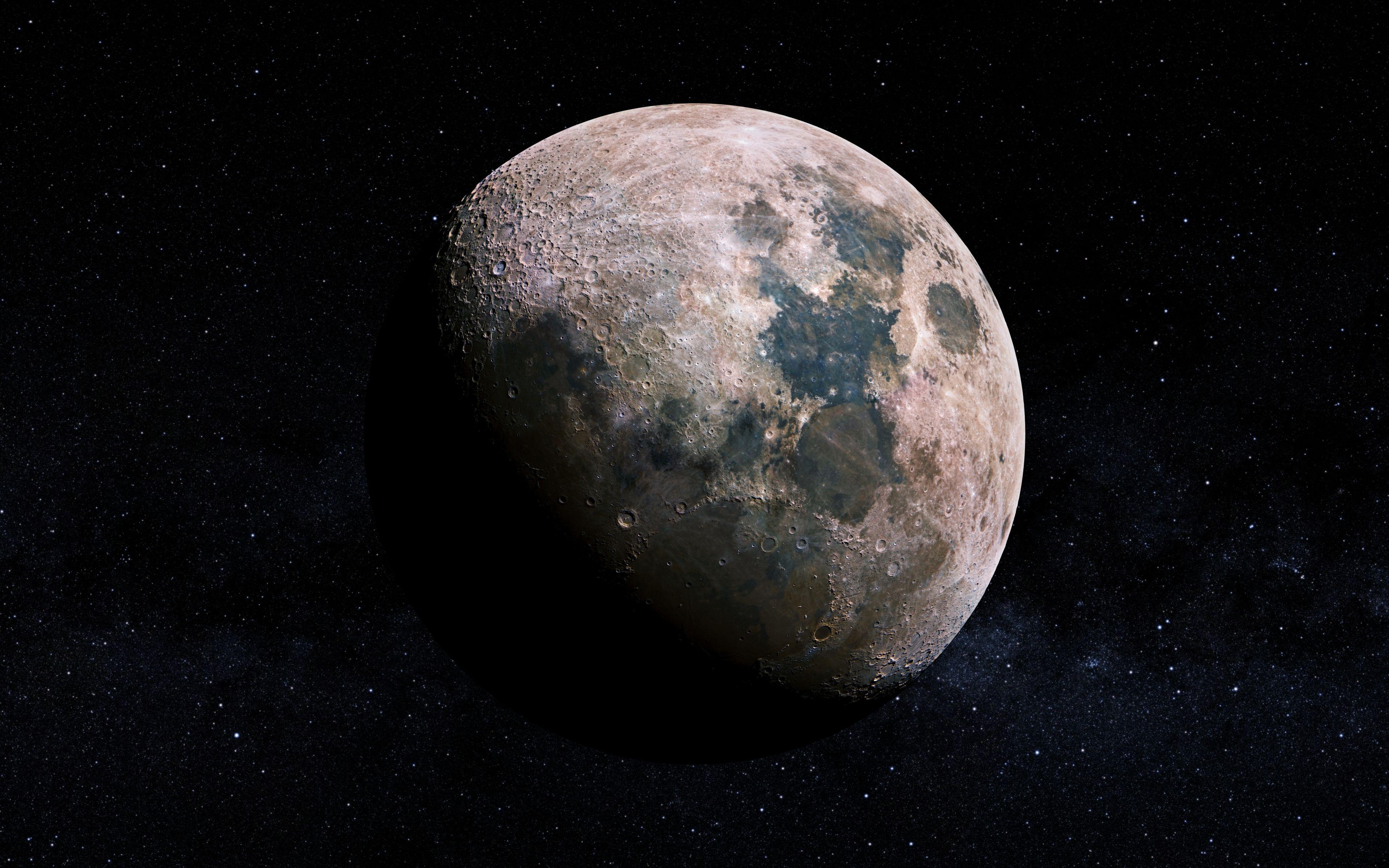
MOON
The Moon is Earth's only natural satellite and plays a significant role in various processes on Earth, including tides, stabilizing the planet's axis, and influencing the length of days.